
 Marine Protected Area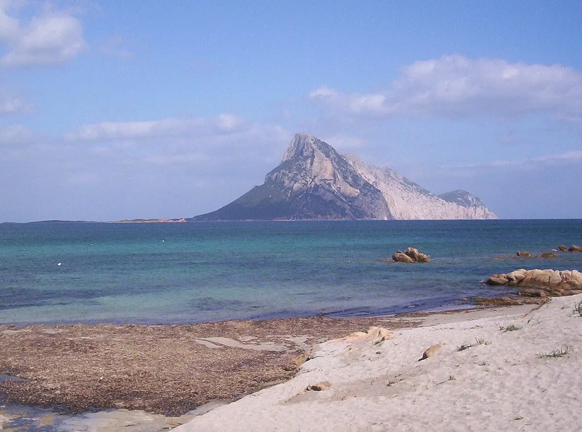
Marine Protected Area
Tavolara Island
The limestone giant of the Tavolara – Punta Coda Cavallo MPA
Olbia · North-East
- DifficultyEasy
- AccessBy boat
- SeasonMay – October
- SeabedGranite rock and seagrass
At a glance: Easy difficulty, access by boat. Recommended season: May – October. Seabed: granite rock and seagrass.
What you will see
- Posidonia seagrass meadows and granite walls
- Sea breams, gilt-heads and Mediterranean barracuda
- Clear water, often with visibility beyond 20 m
- Shallow seabeds, ideal for beginners too
Conditions today
Reading the sea…
Chance of an encounter*


The guide
Tavolara dominates the sea south-east of Olbia with its unmistakable profile. The island is the heart of the Tavolara – Punta Coda Cavallo Marine Protected Area, established in 1997, and its seabeds are among the richest in north-eastern Sardinia.
The best area for snorkelling is Spalmatore di Terra, the sandy spit at the island’s western tip: you swim over posidonia meadows and strips of white sand where sea breams and salema are easy to meet and, with a bit of luck, small schools of barracuda.
The island is a 15–25 minute boat ride from Porto San Paolo, with frequent departures in season. The MPA is divided into zones with different rules: zone A is closed to swimming, so always rely on authorised operators and respect the signs.
This spot lies within a Marine Protected Area: zoning restricts swimming and boating in some stretches. Rely on authorised operators and check the managing body’s current rules.
Getting there and parking
Boats leave from Porto San Paolo, some twenty kilometres south of Olbia: the crossing takes 15–25 minutes and the ticket office is on via Molara, facing the car parks. Besides the small pier car park there is a larger one on viale Pietro Nenni.
The shuttle costs €25 return for adults and €13 for children aged 4 to 12 (free under 3); the guided trip costs €42 and €20. Both include a €2 environmental contribution to the marine protected area.
Departures run from 09:00 to 13:30, with returns until 18:30. Turn up at the ticket office 40 minutes early: in high season the boats fill up.
Where to get in the water
- Spalmatore di Terra
The sand spit at the western tip of the island: you walk in from the beach onto shallow sand and seagrass, the right place for a first outing with a mask.
- The granite walls on the west side
Just beside the beach the rock drops away faster: this is where you meet sea breams and salema, and with luck small schools of barracuda. Needs a calm sea.
- Zone A of the MPA
Not an entry point: in the integral reserve you cannot get in the water and cannot transit. Authorised boat trips know where it ends.
Marine protected area rules
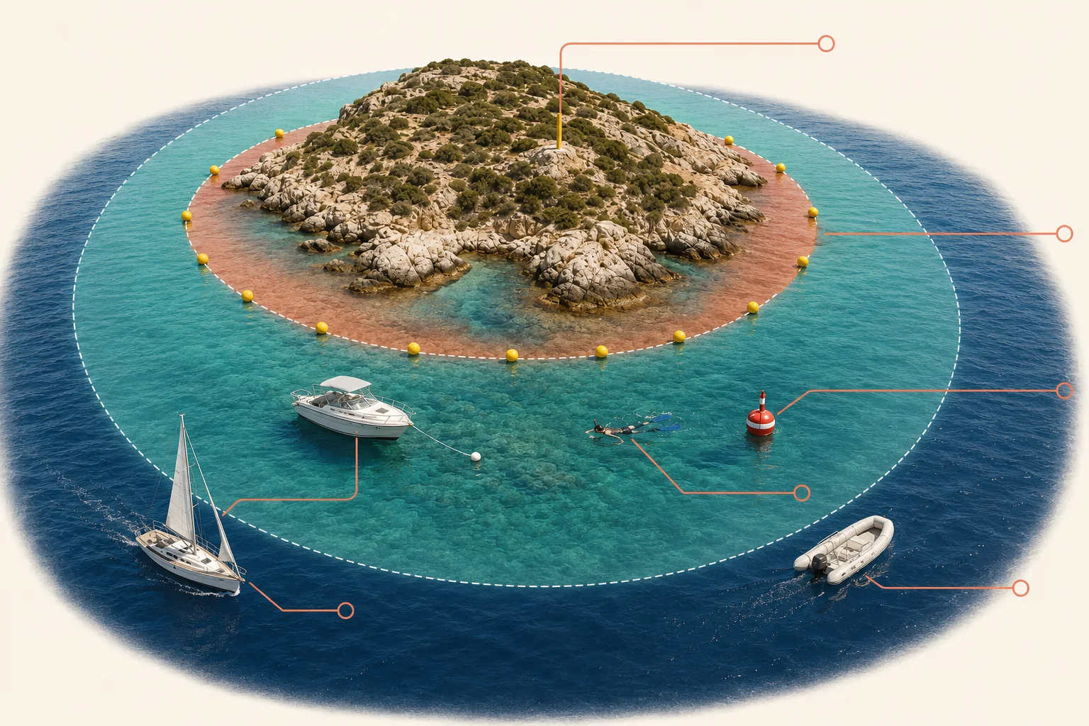
- In zone A (integral reserve) swimming and transit are forbidden: you may only be aboard craft authorised by the marine protected area.
- In zone B swimming is free and breath-hold snorkelling is freely allowed; scuba diving is reserved for dive centres and authorised individuals.
- In zone C swimming and underwater activity are free, within the limits set to protect the environment.
- Spearfishing is banned across the whole marine protected area, as are jet skis and towed water sports in zones B and C.
- Anchoring is forbidden except on sandy or pebbly bottoms and in equipped areas: seagrass is destroyed in a moment and grows back over decades.
What you can do, zone by zone
| Zone Aintegral reserve | Zone Bgeneral reserve | Zone Cpartial reserve | |
|---|---|---|---|
| Swimming | forbidden | allowed | allowed |
| Breath-hold snorkelling | forbidden | allowed | allowed |
| Scuba diving | forbidden | with authorisation | with authorisation |
| Spearfishing | forbidden | forbidden | forbidden |
| Powered navigation | forbidden | regulated | regulated |
Established by D.M. 299 del 3 dicembre 2014 · 15,357 hectares · managed by Consorzio di gestione dell’AMP · source
Services on site
- Porto San Paolo has the ticket office, bars and car parks; on the island there is a restaurant at Spalmatore, but no gear rental: bring your own mask and fins.
- There is no shade on the Spalmatore beach: hat, a shirt in the water and resistant sunscreen.
Safety
- Emergencies at sea: 1530 (Coast Guard) or 112.
- In strong wind departures are cancelled: if the mistral is blowing hard, check before driving to Porto San Paolo.
- The island is reached by sea only: the stretch between the pier and Spalmatore is crossed by boats, so stay close to shore and use a marker buoy if you move away from it.
If the sea is rough, go here
- With mistral or ponenteSan Teodoro and Cala BrandinchiSan Teodoro
- With mistral or ponenteCala Gonone and the Gulf of OroseiDorgali
Practical data checked on 25 July 2026 · source
Frequently asked questions
How do you get to Tavolara Island?
Tavolara can only be reached by boat from Porto San Paolo, in 15–25 minutes; in season departures run frequently all day.
Is Tavolara suitable for beginners?
Yes: the Spalmatore di Terra area has shallow sand-and-seagrass beds, suitable even for first-time snorkellers.
Are any areas closed to swimming?
Yes. Zone A of the Marine Protected Area is closed to swimming: rely on authorised operators and respect the signs.
How much is the crossing to Tavolara?
The shuttle costs €25 return for adults and €13 for children aged 4 to 12, free under 3. The guided trip costs €42 and €20. Both include a €2 environmental contribution to the marine protected area.
Can you snorkel at Tavolara without a boat?
No: the island is reached by sea only. From land you still have the Porto San Paolo shore, but the seagrass meadows and granite walls Tavolara is known for are at the island.
Is there gear rental on the island?
No. There is a restaurant at Spalmatore but no rental: bring your own mask, snorkel and fins.
When is the best time for Tavolara?
From May to October, with the clearest water between June and September. In a stiff mistral the boats are cancelled, so check before driving to Porto San Paolo.
Plan your trip
The tours in detail
Learn more
Blog Useful reads for this area
Keep exploring
Other spots
Marine Protected Area Dolphin gulf
Figarolo Islet
* The encounter percentages are indicative estimates, worked out by combining each species’ typical habitat with the characteristics of the spot. They are not survey data: whether the fish are actually there depends on the season, the weather, the time of day, sea conditions and, not least, a bit of luck. Always respect marine life and the rules of protected areas.