
 Marine Protected Area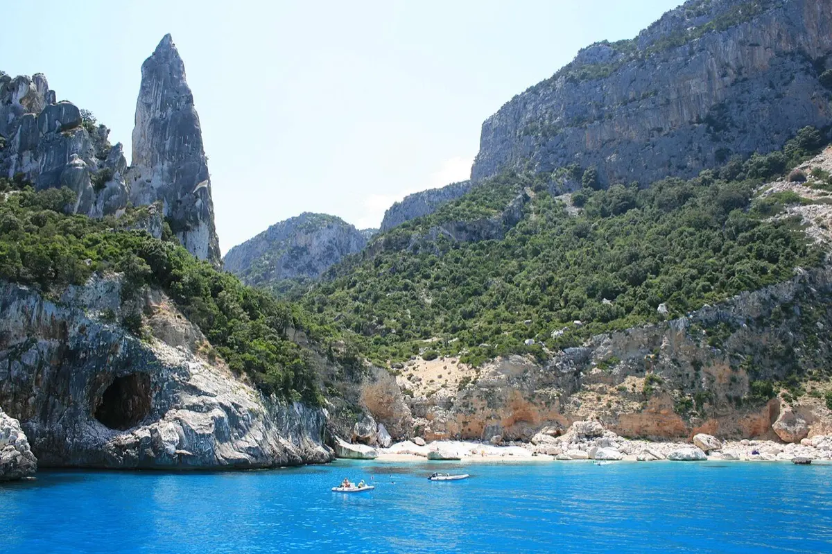
Cliffs and spires
Baunei Coast
The southern side of the Gulf of Orosei, from Pedra Longa to Goloritzè
Baunei · Central-East
- DifficultyIntermediate
- AccessBy boat
- SeasonJune – September
- SeabedLimestone cliffs and white pebbles
At a glance: Intermediate difficulty, access by boat. Recommended season: June – September. Seabed: limestone cliffs and white pebbles.
What you will see
- Cala Goloritzè with its arch and 143 m spire
- The Pedra Longa monolith rising from the blue
- Vertical, transparent water beneath the cliffs
- Departures from Santa Maria Navarrese and Arbatax
Conditions today
Reading the sea…
Chance of an encounter*


The guide
The Baunei coast is the southern half of the Gulf of Orosei: a limestone highland plunging into the sea for kilometres, with no roads and no houses. Dinghies and cruise boats leave from Santa Maria Navarrese and Arbatax and work their way up the coast past Goloritzè, Mariolu and the caves.
Cala Goloritzè is the icon: the rock arch, the spire beloved by climbers and water shading from pebble-white to deep blue. It is a natural monument, with capped access from land and a no-mooring rule for boats, which stop offshore — and right there, beneath the wall, the snorkelling is at its best.
The character here is vertical: the bottom drops away fast and you often swim over open blue, among sea breams, brown meagre and the odd grouper on the shaded walls. It suits those already at ease in deep water; the reward is the colours — and in August the sea is best enjoyed on the first departures of the morning.
Frequently asked questions
Where do trips to the Baunei coast leave from?
From Santa Maria Navarrese and Arbatax: dinghies and cruise boats work up the coast past Pedra Longa, Goloritzè and Cala Mariolu.
Can boats land at Cala Goloritzè?
No: landing is forbidden and boats stop offshore, where you swim beneath the wall. On foot, access from the Golgo plateau is paid and capped.
Is this coast for beginners?
The level is intermediate: the bottom drops away fast and you often swim over open blue. You need to be at ease in deep water.
Plan your trip
The tours in detail
Learn more
Blog Useful reads for this area
Keep exploring
Other spots
Marine Protected Area Marine Protected Area
Capo Carbonara
* The encounter percentages are indicative estimates, worked out by combining each species’ typical habitat with the characteristics of the spot. They are not survey data: whether the fish are actually there depends on the season, the weather, the time of day, sea conditions and, not least, a bit of luck. Always respect marine life and the rules of protected areas.